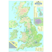
Features Include:
- Laminated map of UK and Republic of Ireland road network
- Shows motorways, A-roads, and B-roads within M25
- Inset with rail, ferry and airport phone numbers
- Mileage chart with distances between 66 major towns and cities
- Measures 1200x830mm, scale 1:800,000
- 2011 edition: includes 2009 administrative changes
General
-
Product Code
MM90401
-
Description
British Isles Motoring Map. Motorways, primary and A and B roads depicted with insets showing Greater London main routes and a mileage chart. Size: 50x35. Scale - 12.5 miles: 1 inch. - OUT OF STOCK
-
Marketing
British Isles Motoring Map. Motorways, primary and A and B roads depicted with insets showing Greater London main routes and a mileage chart. Size: 50x35. Scale - 12.5 miles: 1 inch. - OUT OF STOCK
-
2019 Irish catalogue page no
843
-
Brand
Map Marketing
-
Contains timber or derived materials
Yes
-
Country of Origin
United Kingdom
-
Cross Sell
MM05271
-
Depth (mm)
141
-
Drywipe?
Yes
-
Electrical Product (Y/N)
No
-
Energy Star (Y/N)
No
-
Green Product
No
-
Height (mm)
72
-
ISO 14001 (Y/N)
No
-
Major Minor Major Product Group
56
-
Major Minor Minor Product Group
030
-
Minimum Recycled Content (%)
25
-
OEM
BIM
-
Pack Unit of Sale Barcode 1
5015822904011
-
Pre Consumer Recycled Content
100
-
Pre or Post Consumer?
Pre Consumer
-
Print Selling Unit
Each
-
Product Type
Wall Maps
-
REACH Chemical Registration required (Y/N)
No
-
REACH Requires Health & Safety Data Sheet
No
-
Recyclable (Yes/No)
No
-
Recycled %
0
-
Returns Allowed
Yes
-
UK VAT Codes
Z
-
UNSPSC Code
55101501
-
Weight (kg)
0.6
-
Width (mm)
105